International Journal of Scientific & Engineering Research, Volume 5, Issue 4, April-2014 1492
ISSN 2229-5518
Outline of the Proposed Research Work
1. Name of the Scholar: Mr Avinash Shah
2. Title of the Research: Methods of Estimation of the differential variability of Sea surface Temperatures using Numerical Modelling
3. Location:
1. Organisation/ Department where the work is to be done:
Department of Mathematics C U Shah Science College
2. Geographical area of Investigation, if any:
The Gulf of Khambhat (formerly known as the Gulf of Cambay) is an inlet of the Arabian Sea along the west coast of India, in the state of Gujarat. It is about
80 miles in length, and divides the Kathiawar peninsula to the west from the eastern part of Gujarat state.
There are plans to construct a 30km dam across the gulf. This is detailed in the page... of Synopsis.
3. Importance / Rationale of proposed Investigation:
IJSER © 2014 http://www.ijser.org
International Journal of Scientific & Engineering Research, Volume 5, Issue 4, April-2014 1493
ISSN 2229-5518
One-dimensional mixed layer ocean model is improved and developed with the capability of representing the dominant processes involved in the development of the diurnal cycle of SSTs. The model is forced with operational forecast data and used to build spatial maps of the diurnal warming. Details of the rationale has been given in page no….
4. Scope of the proposed study:
The scope of the proposed study have been written in page 11 of the synopsis.
5. Review of work done on the subject:
Brief review of the proposed study done in this field is given on page 12 of the synopsis.
6. Research Gaps identified in the proposed field of investigation:
The research gaps as mentioned earlier is between the new targeting method and existing methods, it explicitly predicts the reduction in forecast error variance as the difference between the forecast error variance with or without the targeted observations. This has been explained in page 14 of the synopsis.
7. Objectives of the proposed study:
Knowledge of sea surface temperatures (SSTs) has importance for humankind with many valuable social and economic benefits. The SST
IJSER © 2014 http://www.ijser.org
International Journal of Scientific & Engineering Research, Volume 5, Issue 4, April-2014 1494
ISSN 2229-5518
is a crucial component in many physical, biological, and chemical processes within the Earth system. It is one of the most important properties governing the exchange of energy between the atmosphere and ocean and as such is of paramount importance in air-sea ux calculations. A good knowledge of SST is therefore germane in our understanding of upper ocean physical, biogeochemical processes, and air-sea interaction. SST is a variable widely used for describing ocean circulation and dynamics. It has an important role in Numerical Weather Prediction (NWP) as a boundary condition in General Circulation Models (GCMs) and therefore is valuable for weather forecasting. For example a necessary condition for the genesis of tropical cyclones is that the SST be above approximately 26C and SST maps are used to evaluate oceanic heat content, which is important for predicting hurricane intensity development. It also has an important role in climate science where it is viewed as a key indicator of climate change and variability developed in even better than the earlier detailed in page 16 of the synopsis.
8. Research Methodology:
1. Hypothesis to be tested:
Has been explained in the page 16.
2. Sources of Information:
The list of all supporting materials has been listed in page 16.
1. Literature survey
2. Other information
3. Reference Books and other informations
4. Tools and Techniques of Research:
IJSER © 2014 http://www.ijser.org
International Journal of Scientific & Engineering Research, Volume 5, Issue 4, April-2014 1495
ISSN 2229-5518
The Tools and techniques of mathematics which are required for the analysis will be used for the research work this has been explained in page 16 of the synopsis.
5. Tentative Chapterization:
The thesis has been organised in eight chapters and the tentative chapterization of the thesis is given in page ....of the synopsis.
1. Introduction
2. The Model
3. The Oceanic Radiant Heating
4. Experiments without Assimilation
5. SST Data
6. Direct Insertion
7. Cloud Correction
8. Mixed Layer Adjustment
9. Summary
10. Conclusions
11. Bibliography:
The list of the referred books, journals, research papers and searched websites are given on page ... of the synopsis.
IJSER © 2014 http://www.ijser.org
International Journal of Scientific & Engineering Research, Volume 5, Issue 4, April-2014 1496
ISSN 2229-5518
Outline Approved................................
Signature of the Candidate with Date......................... Signature of the Supervisor with date.......................................
Index
Srno | Contents | Page No |
1 | Name of the Scholar | 1 |
2 | Title of the Research | 1 |
3 | Location | 1 |
| Organisation/ Department where the work is to be done Geographical Area of proposed investigation | |
4 | Importance / Rationale of the proposed Study | 5 |
5 | Scope of the proposed Study | 11 |
6 | Review of work already done on the subject | 12 |
7 | Research Gaps identified in the proposed | 14 |
IJSER © 2014 http://www.ijser.org
International Journal of Scientific & Engineering Research, Volume 5, Issue 4, April-2014 1497
ISSN 2229-5518
| field of Investigation | |
8 | Objectives of the proposed study | 16 |
9 | Research Methodology Hypothesis to be tested Source of Information Tools and techniques of Research | 16 |
10 | Tentative Chapterization | 20 |
11 | Bibliography | 21 |
Outline of the Proposed Research Work
1. Name of the Scholar: Ms Avinash Shah
2. Title of the Research: Methods Methods of Estimation of the differential variability of Sea surface Temperatures using Numerical Modelling
IJSER © 2014 http://www.ijser.org
International Journal of Scientific & Engineering Research, Volume 5, Issue 4, April-2014 1498
ISSN 2229-5518
3. Location:
1. Organisation/ Department where the work is to be done:
Department of Mathematics C U Shah Science,College
2. Geographical area of Investigation, if any:
Gulf of Khambhat - earlier known as Gulf of Cambay - centers around findings made in December 2000 by the National Institute of Ocean Technology (NIOT). NIOT came across palaeo river channels in the sea. These were seen by the scientists involved to be the extension of the present day major rivers of the area. In a similar marine survey, in a Coastal Research Ship during
1999-2000 when Dr S Badrinaryan was the Chief Scientist, several unusual frames of Side Scan Sonar images were encountered. These had square and rectangular features in an arranged geometric fashion which are not expected by the scientist in the marine domain. As per the scientist involved such features are unlikely to be due to natural marine geological processes. This made the scientists suspect that human workmanship must have been involved here. The surveys were followed up in the following years and a couple of palaeo channels of old rivers
were discovered in the middle of the
IJSER © 2014 http://www.ijser.org
International Journal of Scientific & Engineering Research, Volume 5, Issue 4, April-2014 1499
ISSN 2229-5518
Khambhat area under 20-40m water depths, at a distance of about 20 km from the present day coast.
The Gulf of Khambhat was formed by a major rift that resulted in a down sliding of the Khambhat region. The area is very tectonically active today, and several faults can be found in the gulf. Periodic earthquakes also occur here. This knowledge has led several archeologists to state that the site is not in a secure enough context to be reliably dated. Because of the tectonic activity and strong currents, these archeologists claim that there is not sufficient stratification to be sure the recovered artifacts can be associated with the site.
Gulf of Khambhat (between 72°2′E to 72°6′E and 21° to 22°2′N) is one of the major fishing areas along western coast of India . It is about 80 km wide at mouth and tapers to 25 km along the coast. It is about 140 km in length and is characterised by several inlets and creeks formed by the confluence of rivers. The Gulf of Khambhat is shallow with about 30 m average depth and abounds in shoals and sandbanks. It is known for its extreme tides. The tidal range at Gulf of Khambhat is known to be one of the largest along the Indian coastline.
Geography:
Gujarat is a water deficient State. It occupies 6.4% of land area of the country and has 5% of the country’s human population, but its surface water resource is only 2% OF THE COUNTRY. The per capita per annum water availability is 990 cubic meter in the State which is much below the minimum requirement of 1700 cubic meter. Every year, 38000 million cubic meter average surface Water is available in the State.
However, even after including Sardar Sarovar Project (SSP) , only 20480 million cubic meter 54% is possible to store. There is no suitable site of land in the state, available for the creation of river valley project to store surplus/ untapped above 40% surface water. In such a circunstances, the Gulf of Khambhat is an eligible option to create a reservoir by construction of a Gulf closure dam which can sore about 10,000 million cubic meter water inflows of the rivers ( Narmada , Dhadhar, Mahi, Sabarmati, and some of the Saurashtra rivers), which accounts for 25% of total surface water resources of Gujarat. Creation of this fresh water reservoirs does
IJSER © 2014 http://www.ijser.org
International Journal of Scientific & Engineering Research, Volume 5, Issue 4, April-2014 1500
ISSN 2229-5518
not involve any land acquisition or rehabilitation of people, and will serve as a life line of the Saurastra region as well as an accelerator for the growing economic activities of Gujarat State.

The Gulf of Khambhat extends from North to South about 200 Km and the width varies from 25 Km at the inner end to 150 Km at the outer mouth, covering an area of 17000 sq. Km , of which only 2000 sq Km will be enclosed by constructing a dam across the Gulf between Bhavnagar and Dahej.
1. World’s largest man made fresh water reservoir in the sea.
2. Highest importance and priority to irrigation and drinking water for Saurashtra and Central Gujarat regions.
3. The Reservoir will have the storage more than double the Sardar Sarovar
(Narmada Reservoir) capacity.
4. 10.54 lakh ha land in 39 talukas of 6 districts of Saurashtra region will get irrigation benefit facility including rejuvenation of rivers. More than 60 existing dams will get permanently filled up with water.
5. Wind and solar energy will be generated which can also be used for lifting fresh water from the reservoir to the canal.
6. Bhavnagar port will get revived which will result into speedy development of the region.
7. There will be large saving in travel time and fuel due to reduction in distance by about 200 km between Bhavnagar to Surat-Mumbai.
8. Saline ground water of coastal area of Saurashtra & Central Gujarat will get
converted into fresh water with reduction in soil salinity.
9. Substaintial improvement in ground water quality as well as soil salinity of coastal area of Saurashtra & Central Gujarat.
10. About 2 lakh ha land along the periphery of the reservoir will be opened up for development towards value-based land utilization.
11. Enhanced benefit of world class industrial estate like Dahej and Dholera will be
available to Bhavnagar/Saurashtra region.

IJSER © 2014 http://www.ijser.org
International Journal of Scientific & Engineering Research, Volume 5, Issue 4, April-2014 1501


ISSN 2229-5518


This image cannot currently be displayed.

Khambhat


Satellite Image of Gulf of
This image cannot currently be displayed.

Gulf of Khambhat, also called Gulf of Cambay, trumpet-shaped gulf of the Arabian Sea, indenting northward the coast of Gujarat state, western India, between Mumbai (Bombay) and the Kathiawar Peninsula. It is
120 miles (190 km) wide at its mouth between Diu and Daman, but it rapidly narrows to 15 miles (24 km). The gulf receives many rivers, including the Sabarmati, Mahi, Narmada (Narbada), and Tapti. Its shape and its orientation in relation to the southwest monsoon winds account for its high tidal range
(40 feet [12 metres]) and the high velocity of the entering tides. Shoals and
IJSER © 2014 http://www.ijser.org
International Journal of Scientific & Engineering Research, Volume 5, Issue 4, April-2014 1502
ISSN 2229-5518
sandbanks are treacherous to navigation, and all the gulf ports have suffered from silting caused by tides and flood torrents from the rivers.
On the eastern side of the gulf are Bharuch, one of the oldest Indian ports, and Surat, identified with early European commercial contacts with India. The town of Khambhat is at the head of the gulf. Although the importance of the gulf ports has been only local, the discovery and exploration of oil—particularly near Bharuch, around the head of the gulf, and in the offshore Mumbai High field—has caused a commercial revival in the region.
Climate:
With unprecedented rate of development in the countries surrounding the gulfs of the Arabian Sea, there has been a rapid warming of these gulfs. In this regard, using Advanced Very High Resolution Radiometer (AVHRR) data from 1985 to 2009, a climatological study of Sea Surface Temperature (SST) and its inter annual variability in the Persian Gulf (PG), Gulf of Oman (GO), Gulf of Aden (GA), Gulf of Kutch (KTCH), Gulf of Khambhat (KMBT), and Red Sea (RS) was carried out using the normalized SST anomaly index. KTCH, KMBT, and GA pursued the typical Arabian Sea basin bimodal SST pattern, whereas PG, GO, and RS followed unimodal SST curve. In the western gulfs and RS, from 1985 to 1991-
1992, cooling was observed followed by rapid warming phase from 1993 onwards, whereas in the eastern gulfs, the phase of sharp rise of SST was observed from 1995 onwards. Strong influence of the El Niño and La Niña and the Indian Ocean Dipole on interannual variability of SST of gulfs was observed. Annual and seasonal increase of SST was lower in the eastern gulfs than the western gulfs. RS showed the highest annual increase of normalized SST anomaly (+0.64/decade) followed by PG (+0.4/decade).
12. Importance / Rationale of proposed Investigation:
The SST may be perceived as being determined by a balance of many processes, including air-sea exchange, ocean transport, and ocean mixing. Figure illustrates these principal environmental processes that ae ct SST. An understanding of these processes and their interactions
IJSER © 2014 http://www.ijser.org
International Journal of Scientific & Engineering Research, Volume 5, Issue 4, April-2014 1503
ISSN 2229-5518
is vital for the benecial inclusion of global high resolution SST
observations into ocean models.
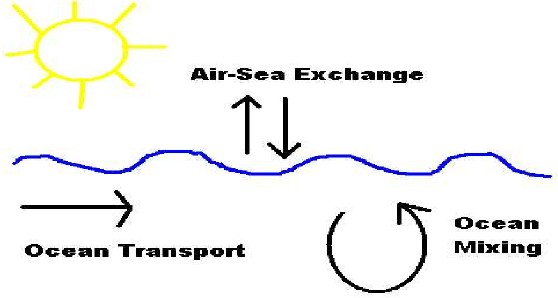
A schematic diagram illustrating the various processes that inuence
SST in the ocean-atmosphere system.
A limited number of in-situ observations of SST are available from ocean moorings, buoys, and ship observations. Argo oats [47] provide vital p r ol e information of temperature and salinity needed to initialise ocean models. In this thesis a few research moorings providing intensive periods of observations are used to validate an ocean model and develop assimilation routines.
SST measured from Earth observation satellites is increasingly required for use in the context of operational monitoring and forecasting of the ocean, for assimilation into coupled ocean-atmosphere model systems
and for applications in short-term NWP and longer term climate
IJSER © 2014 http://www.ijser.org
International Journal of Scientific & Engineering Research, Volume 5, Issue 4, April-2014 1504
ISSN 2229-5518
change detection. The wealth of satellite SST data now available for scientic research opens the possibility of large improvements to SST estimation. Currently there are many dierent operational SST data products available; most are derived at least in part from satellite systems [106]. Space borne SST observations are derived from brightness temperatures as measured by infrared (IR) or microwave (MW) radiometers. The performance of infrared radiometers is hampered by cloud cover, whereas the microwave radiation is able to propagate through clouds, but observations can be contaminated by heavy rainfall (see Section 6.3 for more information).
13. Scope of the proposed Study :
As the solar heating warms and stabilises the upper ocean, limiting the downward penetration of turbulent wind mixing, the thermal response produces a warm st r a ti e d layer in which air-sea uxes of heat and momentum are surface trapped. The trapping depth is set by the opposing eects of stabilising heat ux and destabilising surface stress [104]. This warm layer is associated with the rise in SST and decrease in mixed layer depth. This phenomenon results in daily variability of the upper ocean vertical temperature p ro b e . An idealized typical day and night p rob e is seen in Figure.
A variety of SST observations from various sources are often used in conjunction without taking into account the depth at which these temperature observations are representative. Satellite observations
especially, represent a near surface layer; however, these observations
IJSER © 2014 http://www.ijser.org
International Journal of Scientific & Engineering Research, Volume 5, Issue 4, April-2014 1505
ISSN 2229-5518
are assimilated into ocean models that do not resolve such geospatial structure. The SST at 5 metres (the depth at the centre of the top grid box in a typical high resolution ocean model) can be several degrees cooler than the near surface temperature. Without knowing the temperature differences at the relevant depths we cannot utilise all the information content available in observations.
The complex interactions across and in the vicinity of the marine boundary layer have been highlighted and a detailed description given of the physical processes at play in the development of the diurnal cycle of SSTs. Although the physics are known in some detail, modelling this non-linear system is still very much in its infancy. Developments in mixed layer models have been seen in recent decades, but rarely has this focused on modelling the diurnal cycle of SSTs (see the above section). As such the rst aim of this thesis is to improve and develop modelling capabilities in this area.
Another issue highlighted in this introduction is how satellite observations of SST represent temperatures at the skin and sub-skin layer which are very much inuenced by diurnal stratication, whereas top grid boxes in climate and ocean models represent a temperature at a much deeper depth without any (or a much reduced) diurnal vari- ability. This discrepancy is a concern for weather forecasting, four- dimensional data assimilation, and ocean-atmosphere coupled modelling, and is only beginning to be addressed as illustrated by the recent article of Zeng and Beljaars [158], who develop a prognostic
scheme of sea surface skin temperature for modelling and data
IJSER © 2014 http://www.ijser.org
International Journal of Scientific & Engineering Research, Volume 5, Issue 4, April-2014 1506
ISSN 2229-5518
assimilation. The second aim of the thesis is therefore to provide an accurate bridge between skin and bulk temperatures, and to develop an observation operator for use in the data assimilation process by providing an accurate transformation from observation space to model space.
Figure: A schematic diagram showing a typical vertical temperature structure of the upper ocean at a) night and b) day
IJSER © 2014 http://www.ijser.org
International Journal of Scientific & Engineering Research, Volume 5, Issue 4, April-2014 1507
ISSN 2229-5518
Attempts to model the upper ocean response to diurnal heating, cooling, and wind mixing are limited in number. Accurately modelling diurnal variability is d if f ic u lt as it involves the complex non-linear interaction between ocean and atmosphere. However, attention should focus on a few core issues: the choice of mixing parameterisations, ux forcing resolution, vertical grid resolution, and the penetration of solar radiation. In this section a review of studies that have specially focused on modeling the diurnal cycle of SSTs is presented, focusing on the above issues.
1. Review of the work already done on the subject:
The dynamic coupling of oceanic and atmospheric processes is inextricably linked to the uxes across the marine boundary layer. Knowledge of their variability on dierent space-time scales is therefore crucial for understanding ocean-atmosphere interaction. Thermodynamic interactions across the air-sea interface are complex and varied. The sea surface receives short-wave solar radiation of which an amount is rejected while the remainder penetrates into the oceanic surface layer. Long-wave radiation is emitted from the ocean surface into the atmosphere, as well as from the atmosphere into the ocean surface. Alongside the radioactive transfers, are sensible and latent heat transfer. Sensible heat raises or lowers air temperature by conduction. The larger component is the latent heat transfer due to evaporation. Momentum transfer is also in operation generated as the winds blow across the air-sea interface.
Calibration based on radiometric measurements can improve the accuracy of the formula for particular regions. For example this was
done by Schiano [120] over the Mediterranean Sea where the
IJSER © 2014 http://www.ijser.org
International Journal of Scientific & Engineering Research, Volume 5, Issue 4, April-2014 1508
ISSN 2229-5518
transmission coecien t, , was reduced from 0.7 to 0.66 due to a regional misevaluation of aerosols and water vapour attenuation. Schiano also showed how the coecient Aa could vary according to measured water vapour density. This was only done in the clear sky case indicating an error not in the cloud correction of Reed, but the transmission coecien t originally chosen by Seckel and Beaudry [122]. A correction using an inverse method and direct ocean transport estimates by Isemer et al [55] over the North Atlantic Ocean also slightly reduced the transmission coecien t from 0.7 to 0.69 but also increased the cloud cover c o eci en t , Cn, from 062 to 0636. However an empirical formula such as this cannot be universally calibrated and its accuracy will always be restricted because the surface insolation is determined by not only the portion of cloud cover, but also the optical thickness of the cloud, which varies widely under the same cloud amount.
The major difference between the traditional method and method of assimilation which is hypothesised is that it is more accurate and advanced and can help in the mathematical model formation in dealing with the assimilation.
2. Research Gaps identified in the proposed field of Investigation:
In the Indian context, the recent finding, that amongst the oceans, the warming of the Indian Ocean is second highest , is a cause of worry and calls for immediate attention. Even though climatological studies have been done in the past in the Indian Ocean encompassing the Arabian Sea and the Bay of Bengal , a comparative analysis of the changing Sea Surface Temperature (SST) pattern the gulfs of Arabian Sea (Persian Gulf, Gulf of Oman, Gulf of Aden, Gulf of Kutch, and Gulf of Khambhat) and the Red sea has not been done. The gulfs of the Arabian Sea are not just strategically important with rich sources of oil and natural gas but are also the hot spots of the marine biodiversity. However, in the recent years, there has been an expeditious change in the marine ecosystem of the eastern and western gulfs of the Arabian Sea and the Red Sea, owing to anthropogenic interference. Since 1990s, 40% of the coasts of the Persian Gulf
have been modified . The Persian Gulf and the Red Sea areas have been
IJSER © 2014 http://www.ijser.org
International Journal of Scientific & Engineering Research, Volume 5, Issue 4, April-2014 1509
ISSN 2229-5518
reported to be warming rapidly owing to the developmental projects undertaken in the surrounding coastal countries . The Gulf of Kutch on the Indian coast is being aggressively developed as oil importing bases because of its proximity to the Middle East countries [29]. In general, the issues of common concern in the eastern and western gulfs of the Arabian Sea and the Red Sea include various anthropogenic activities like industrialization, coastal infrastructure development projects, setting up of new ports and oil terminals, oil pollution from shipping industry, overfishing, dredging, and increase in tourism and recreational activities, resulting in habitat destruction, changes in temperature and salinity profile, and causing a significant loss of biodiversity .
In this regard, the present work was taken up to study the monthly, seasonal, and annual pattern of Sea Surface Temperature (SST) and to analyse its changing pattern with emphasis on interannual variability in the eastern (Gulf of Kutch and Gulf of Khambhat) and the western gulfs (Persian Gulf, Gulf of Oman, and Gulf of Aden) of the Arabian Sea and the Red sea.
For each of the defined areas of study, the monthly images were masked to avoid the influence of the land and clouds using the image processing software ENVI 4.1 and ERDAS 9.0. For analysis all the pixels of the study area were included. Care was taken to exclude the pixels with zero values while averaging. Following Joint Global Ocean Flux Study (JGOFS) , the four climatological seasons described here are(a)northeast monsoon (December–March) (NEM),(b)spring intermonsoon (April-May) (SIM),(c)southwest monsoon (June–September) (SWM), and(d)fall intermonsoon (October-November) (FIM).The climatological mean (CM25) of 25 years (1985–2009) for each month was calculated by averaging the monthly mean (). The interannual variability was analyzed using the monthly normalized anomalies, computed by subtracting the monthly climatological mean (CM25) from the monthly mean () of each year, and normalized to the standard deviation for that month (SD25) and given asThe seasonal and annual normalized anomalies were computed by averaging the monthly normalized anomalies over appropriate seasons and years. Coefficient of variation (CV) was used to express the
magnitude of interannual variability in the annual and the seasonal SST
IJSER © 2014 http://www.ijser.org
International Journal of Scientific & Engineering Research, Volume 5, Issue 4, April-2014 1510
ISSN 2229-5518
for the eastern and the western gulfs of the Arabian Sea and the Red sea and is calculated asTo study the effect of El Niño and La Niña, comparison with ENSO (El Niño-Southern Oscillation) was carried out using the multivariate ENSO index, that is, MEI index, provided by the climate diagnostic centre (http://www.cdc.noaa.gov/).
3. Objectives of the Proposed Study:
The overall focus of this thesis is:
1. The complex interactions across and in the vicinity of the marine boundary layer have been highlighted and a detailed description given of the physical processes at play in the development of the diurnal cycle of SSTs.
2. Another issue highlighted in this introduction is how satellite observations of SST represent temperatures at the skin and sub- skin layer which are very much influenced by diurnal stratification, whereas top grid boxes in climate and ocean models represent a temperature at a much deeper depth without any (or a much reduced) diurnal variability
3. Another area of importance for diurnal cycle modelling is the penetration of solar radiation into the ocean?
4. The second aim of the thesis is therefore to provide an accurate bridge between skin and bulk temperatures, and to develop an
observation operator for use in the data assimilation process by
IJSER © 2014 http://www.ijser.org
International Journal of Scientific & Engineering Research, Volume 5, Issue 4, April-2014 1511
ISSN 2229-5518
providing an accurate transformation from observation space to model space.
5. The di ffi cu l t y in utilising the wealth of satellite SST observations is not only ac-counting for errors associated with the diurnal cycle and skin to bulk differences, but deciding how actually to best assimilate the observations into the model. This difficulty emanates from the question of how to sensibly adjust prognostic variables, and how information transfers from the surface into the ocean depths.
6. the third aim of this thesis will be to develop novel techniques
for making judicious use of available SST data in assimilation
7. Research Methodology:
8. Hypothesis to be tested:
We investigate the behaviour of various phase correction assimilation methods when applied to idealized problems in a simple Quasi-Geostrophic (QG) ocean model. This simple model allows simulation of mesoscale features and unobserved dynamical variables. We present a variety of new phase error assimilation methods and compare them to traditional techniques.
We find that for suitable assimilation problems these new techniques do need to provide some benefit.
IJSER © 2014 http://www.ijser.org
International Journal of Scientific & Engineering Research, Volume 5, Issue 4, April-2014 1512
ISSN 2229-5518
We shall also present a discussion of the principles, advantages and limitations of the identical twin methodology for investigating data assimilation techniques, re-views the general issues involved in numerical ocean modelling and introduces the particular implementation of a quasi- geostrophic two layer ocean model used for the experimental data presented in this thesis. The equation set is described with reference to its ability to represent real, or realistic, structures and features of the large- scale ocean circulation, thus presenting its suitability as a testbed for oceanographic data assimilation techniques. Different methods for generating model runs with qualitatively differing features are discussed, including both the relevance to current issues in operational oceanography and the relation to the theoretical displacement assimilation techniques shall be tested for further.
We shall be presenting a discussion, linked to the adiabatic assumption introduced in the previous chapter, for the use of assimilation techniques which conserve the integral material properties of ocean fluid parcels when performing assimilation with limited data. These conservation constraints are then connected to the related problem of assimilating phase errors into a system. Metrics on the relative magnitude of amplitude and phase errors in fully observed fields are developed and the behaviour of the metrics investigated for the QG ocean model under the application of a variety of traditional and novel assimilation schemes. An example of one operationally active adiabatic assimilation method, the Cooper & Haines scheme, is implemented in the context of the QG layer model and results are shown for the effect on observed and unobserved variables of assimilating surface stream-function. The effect of smoothed observations on small-scale features is discussed, with reference to feedback on large- scale circulation.
We shall introduce a new direct iterative method for phase correcting assimilation, comparable with 3D-VAR. The method is first derived
IJSER © 2014 http://www.ijser.org
International Journal of Scientific & Engineering Research, Volume 5, Issue 4, April-2014 1513
ISSN 2229-5518
theoretically, then implemented for a hierarchy of idealized ocean problems. Convergence is discussed, with reference to the theoretical limits available through rearrangement theory and an improved ‘multigridding’ algorithm developed. Finally the dependence of the method on observations is considered.
Sources of Information:
Literature survey: Literature of books
Other information: Meteorology and Weather forecasting information through the web
Reference Books and other informations: Research papers and Journals which are very useful in the study
9. Tools and Techniques of Research:
The identical twin methodology is to be used to investigate the methods and then details the approximations made in the quasi-geostrophic model used in the numerical experiments.. Following the derivation of the model and a description of its behaviour we conclude by justifying the choices and methods to be used to generate the numerical model and initial conditions used to form ‘true’ and ‘observational’ data in the data assimilation experiments.
Two of the most important and general of these approximations are:
1. The continuum approximation. Rather than modelling individual molecular motions, the fluid is modelled as a continuous medium and it is assumed that the Navier-Stokes equations apply.
IJSER © 2014 http://www.ijser.org
International Journal of Scientific & Engineering Research, Volume 5, Issue 4, April-2014 1514
ISSN 2229-5518
2. Incompressibility. On the horizontal and length-scales of interest to oceanographers changes in density due to pressure variations are negligible. This means the velocity field in the flow is effectively solenoidal (Batchelor, 1967).
3. Tentative Chapterisation:
4. Introduction
5. The Model
6. The Oceanic Radiant Heating
7. Experiments without Assimilation
8. SST Data
9. Direct Insertion
10. Cloud Correction
11. Mixed Layer Adjustment
12. Summary
13. Conclusions
14. Bibliography:
1. J.Icarus Allen, J. R. Siddorn, J. C. Blackford, and F. J. Gilbert.
Turbulence as a control on the microbial loop in a temperate
IJSER © 2014 http://www.ijser.org
International Journal of Scientific & Engineering Research, Volume 5, Issue 4, April-2014 1515
ISSN 2229-5518
seasonally s tr atie d marine systems model. J. Sea Res., 52:120,
2004.
2. S. P. Anderson and R. A. Weller. Surface buoyancy forcing and the mixed layer of the western P a ci c warm pool: Observations and 1d model results. J. Climate, 9:30563085, 1996.
3. I. Andreu-Burillo, J. Holt, R. Proctor, J. D. Annan, I. D. James, and D. Prandle. Assimilation of sea surface temperature in the POL coastal ocean modelling system. J. Mar. Syst., 65:2740,
2007.
4. J. D. Annan and J. C. Hargreaves. Sea surface temperature assimilation for a three-dimensional baroclinic model of shelf seas. Cont. Shelf Res., 19:15071520, 1999.
5. WHOI Upper Ocean Mooring Data
Archive. http://kuvasz.whoi.edu/uopdata/uopda ta.html, April 2007.
6. B. Barnier, L. Siefridt, and P. Marchesiello. Thermal forcing for a global ocean circulation model using a three-year climatology of ECMWF. J. Mar. Syst., 6:363380, 1995.
7. M. J. Bell, R. M. Forbes, and A. Hines. Assessment of the FOAM global data assimilation system for reat-time operational ocean forecasting. J. Mar. Syst., 25:122, 2000.
IJSER © 2014 http://www.ijser.org
1. M. J. Bell, M. J. Martin, and N. K. Nichols. Assimilation of data into an ocean model with systematic errors near the equator. Q. J. R. Meteorol. Soc., 129, 2003.
2. D. J. Bernie, S. J. Woolnough, J. M. Slingo, and E. Guilyardi.
Modelling diurnal and intraseasonal variability of the ocean mixed layer. J. Climate, 18:11901202, 2005.
3. F. Bignami, S. Marullo, R. Santoleri, and M. E. Schiano.
Longwave radiation budget in the Mediterranean Sea. J. Geophys. Res., 100:25012514, 1995.
4. H. Burchard. Simulating the wave-enhanced layer under breaking surface waves with two-equation turbulence models. J. Phys. Oceanogr., 31:31333145, 2001.
5. H. Burchard and K. Bolding. Comparative analysis of four second-moment turbulence closure models for the oceanic mixed layer. J. Phys. Oceanogr., 31:1943 1968, 2001.
6. H. Burchard, K. Bolding, W. Kuhn, A. Meister, T. Neumann, and L. Umlauf. Description of a exible and extendable physical- biogeochemical model system for the water column. J. Mar. Syst., 61:180211, 2006.
7. H. Burchard, K. Bolding, T. P. Rippeth, A. Stips, J. H. Simpson, and J. Sundermann. Microstructure of turbulence in the northern North Sea: comparative study of observations and model simulations. J. Sea. Res., 47:223238, 2002.
8. H. Burchard, K. Bolding, and M. R. Villarreal. GOTM, a General

1516
Ocean Turbulence Model. Theory, implementation and test cases. Tech. Rep. EUR 18745 EN, European Commission, 1999.
9. H. Burchard, H. Lass, V. Mohrholz, L. Umlauf, J. Sellschopp, V.
Fiekas, K. Bolding, and L. Arneborg. Dynamics of medium- intensity dense water plumes in the Arkona Sea, Western Baltic Sea. Ocean Dynamics, 55:391402, 2005.

1517
International Journal of Scientific & Engineering Research, Volume 5, Issue 4, April-2014 1518
ISSN 2229-5518
1. D. B. Chelton and M. H. Freilich. Scatterometer-based assessment of 10-m wind analyses from the operational ECMWF and NCEP numerical weather prediction models. Mon. Wea. Rev., 133:409429, 2005.
2. D. Chen, S. E. Zebiak, and M. A. Cane. Initialization and predictability of a coupled ENSO forecast model. Mon. Wea. Rev., 125:773788, 1997.
3. R. M. Clancy, J. M. Harding, K. D. Pollak, and P. May.
Quantication of improvements in an operational global-scale ocean thermal analysis system. J. Atmos. Oceanic Technol.,
9:5565, 1992.
4. R. M. Clancy, P. A. Phoebus, and K. D. Pollak. An operational global-scale ocean thermal analysis system. J. Atmos. Oceanic Technol., 7:233254, 1990.
5. N. E. Clark, L. Eber, R. M. Laurs, J. A. Renner, and J. F. T.
Saur. Heat exchange between ocean and atmosphere in the eastern north P aci c for 196 1-1971. Technical report, NOAA,
1974.
6. M. C. Cooper and K. Haines. Data assimilation with water property conservation. J. Geophys. Res., 101:10591077, 1996.
7. P. Cornillon and L. Stramma. The distribution of diurnal sea surface warming events in the western Sargasso Sea. J. Geophys. Res., 90:1181111815, 1985.
8. P. D. Craig and M. L. Banner. Modeling wave-enhanced turbulence in the ocean surface layer. J. Phys. Oceanogr.,
IJSER © 2014 http://www.ijser.org
International Journal of Scientific & Engineering Research, Volume 5, Issue 4, April-2014 1519
ISSN 2229-5518
24:25462559, 1994.
9. J. Crank and P. Nicolson. A practical method for numerical evaluation of solutions of partial di erenti al equations of the heat-conduction type. Proc. Cam-bridge Philos. Soc., 43:5067,
1947.
10. G. Danabasoglu, W. G. Large, J. J. Tribbia, P. R. Gent, and B.
P. Briegleb. Diurnal coupling in the tropical oceans of CCSM3. J. Climate, 19:23472365, 2006.
IJSER © 2014 http://www.ijser.org
International Journal of Scientific & Engineering Research, Volume 5, Issue 4, April-2014 1520
ISSN 2229-5518
1. D. Dee and A. M. DaSilva. Data assimilation in the presence of forecast bias. Q. R. Meteorol. Soc., 124:269295, 1998.
2. A. Defant. Physical Oceanography. Pergamon Press, 1961.
3. J. Derber and A. Rosati. A global oceanic data assimilation system. J.
Phys. Oceanogr., 19:13331347, 1989.
4. F-X. Le Dimet and M. Ouberdous. Retrieval of balanced elds: an optimal control method. Tellus, 45A:449461, 1993.
5. F. W. Dobson and S. D. Smith. Bulk models of solar radiation at sea.
Q. J. R. Meteorol. Soc., 114:165182, 1988.
6. C. J. Donlon, P. J. Minnett, C. Gentemann, T. J. Nightingale, I. J.
Barton, B. Ward, and M. J. Murray. Toward improved validation of satellite sea surface temperature measurements for climate research. J. Climate, 15:353369, 2002.
7. C. J. Donlon and the GHRSST-PP Science Team. The recommended GHRSSTPP data processing specications GDS (version 1 revision 1.5). Technical Re-port 17, GHRSST-PP, 2004.
8. T. Ezer and G. Mellor. Data assimilation experiments in the Gulf stream region: How useful are satellite-derived surface data for nowcasting the subsurface elds. J. Atmos. Oceanic Technol.,
14:13791391, 1997.
9. C. W. Fairall, E. F. Bradley, J. S. Godfrey, G. A. Wick, J. B. Edson, and G. S. Young. Cool-skin and warm-layer eects on sea surface temperature. J. Geophys. Res., 101:12951308, 1996.
10. C. W. Fairall, E. F. Bradley, J. E. Hare, A. A. Grachev, and J. B. Edson.
Bulk parameterization of air-sea uxes: Updates and verication for the
IJSER © 2014 http://www.ijser.org
International Journal of Scientific & Engineering Research, Volume 5, Issue 4, April-2014
ISSN 2229-5518
1521
COARE algorithm. J. Climate, 16:571591, 2003.
IJSER © 2014 http/lwww .qser.orq